
It was nearly winter, and I was making my weekly drive north to New Hampshire. I figured it would be interesting to ascend the peak by way of Left Gully. It’s one of the gullies in Tuckerman Ravine. In winter and spring, it’s a ski run. With it being early season, it would be a mixture of snow, rock and ice. Not classic by any measure, but it would be more interesting than the standard Lion’s Head winter-condition ascent route.
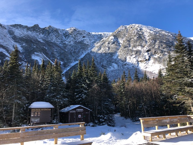
It was a cold November. The Pinkham Notch trailhead was well below freezing and windy. I started hiking up the Tuckerman Ravine trail at dawn. It was a little rocky down low, but it became more uniform snow higher up.
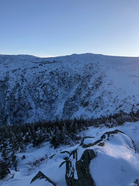
I soon reached “Hojo’s” and got my first view of the upper slopes of the peak. I was on the mountain last week, and the snow coverage had improved since then. The peak must have received at least a foot or two, with the wind having added the rest.
I continued hiking up to the base of the ravine. The conditions began as icy rocks with wind-blasted snow patches. After breaking treeline, it became two feet of snow poking out of the bushes. I post holed a little bit, but I made it to the base of left gully without much trouble.
I put my crampons on and started ascending. As expected, it was annoying. There was enough snow to sink in, but not enough to cover the rocks and ice.
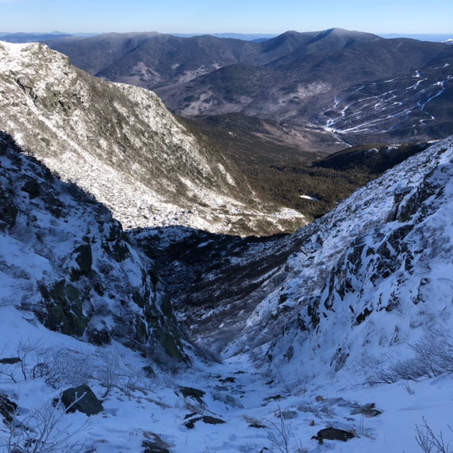
Despite that, the views were awesome. There was nobody in the ravine that day, and I had it to myself. It was nice seeing the mountain progress through all four seasons as well. What would become a wind-slab-filled bowl a month from now was now bony and transitioning. A unique perspective.
As I ascended, it got steeper. It was roughly 40 to 45-degrees, with a short 55-degree step to reach the summit ridge. This matches up with the grade of the ski run it eventually becomes.
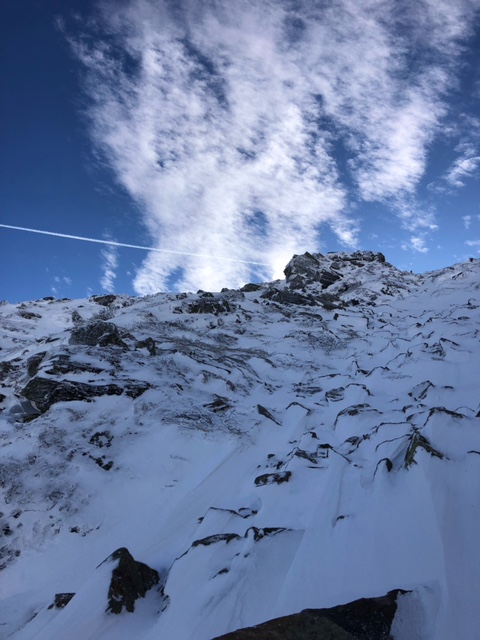
Towards the top, there were a few tiny sections of water ice. It was thin, but verglassed rocks and unsupportable snow surrounded it. Those ice patches were actually the easiest way up.
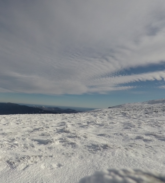
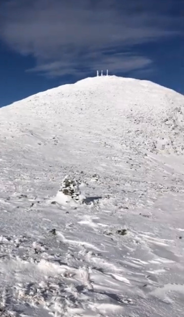
Soon, I topped onto the summit ridge. 50 mph wind gusts blasted me. It couldn’t have been Mt. Washington without some weather, and here it was. It was well below freezing too. I put on a full balaclava, ski goggles, and mittens, which left me well protected.
Unbeknown to me, I wasn’t through the crux of the day yet. Due to the recent snowfall, a thin layer of unconsolidated snow guarded the ridge to the summit. In the summer this ridgeline consists of large and loose granite blocks. With the thin snow covering the rocks, I couldn’t see what was underneath.
I’d take a step and my foot would plunge through the snow and topple a loose block, breaking my stance. Sometimes my leg would plunge between two blocks and I’d have to wrench it out. Traveling here was slow, and I regretted ascending via this route. At least it was character-building.
I cursed and tripped all the way to the top. When I finally summited, clouds had arrived. Everything was whited-out. I caught the Lion’s Head Trail as my descent route. A pair of footsteps through there made navigation easy. Otherwise, I’d have to fumble around with a compass or GPS.
With the short November hours, plus the time wasted by the snow, I reached treeline at sunset. This was near the Lion’s Head rock formation, which has an interesting view of Tuckerman Ravine.
I descended the remaining route through the trees by headlamp. It was uneventful. In the trees, navigation isn’t a problem. There were a few short sections of WI1 water-ice, but they were trivial.
I soon reached the Tuckerman Ravine trail, a downright “backcountry highway.” After that, it was an hour to my car. When I arrived, I was hungry, and drove to North Conway for some food.