
I was in Ketchum, Idaho mountain biking for a couple of days. Mt. Borah was only a few hours of drive away. So, I figured I’d drive over and climb it.
The drive from Ketchum to the Borah Trailhead was beyond gorgeous. Gravel, windy mountain roads punctuated by vast mountain views. I didn’t see more than a dozen cars the whole drive.
I pulled into the trailhead — which also has campsites — and found it empty. Not surprising, given there was still snow on the ridge and it was a weekday.
As I was packing and cooking, another car pulled in. This guy was from Idaho Falls and climbing Borah too. We discussed our plans and then went to sleep in our respective vehicles.
I woke up the next morning. I was deciding between hiking boots and trail runners. The snow on the knife-edge would be more secure with boots. But, I couldn’t tell exactly how much snow there would be. In the end, I chose boots. I wasn’t interested in speed for this ascent, and rather be safe than sorry.
The first several thousand feet of gain is on a well-maintained trail straight up through some trees. There aren’t any unnecessary switchbacks. It’s very efficient — well over a thousand feet of gain per mile.
Then, I crested above treeline. Another 1,000 feet or so of gain on sort-of-loose class 2 slopes brought me to Chickenout Ridge. So-called, because when people climb it, they chicken out because of the exposure.
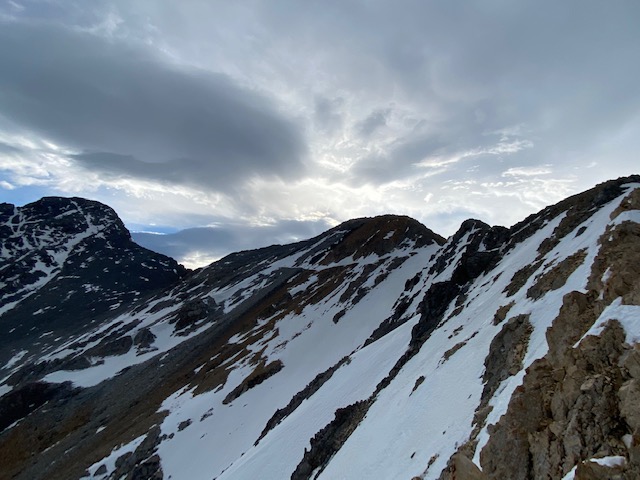
The ridge was class 3 on good rock. The exposure was cool, and it’s always easier than it looks. Handholds and footholds everywhere.
Knife-edged snowfields interrupted the ridge pretty often. But, the snow was soft enough to cross these easily. They were never as bad as they looked, and it was a cruiser day.
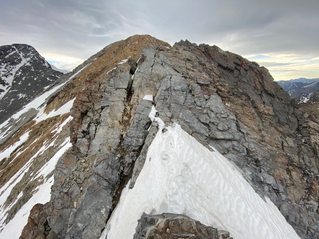
The “crux” of the ridge was a short, exposed 10-foot class 4 down-climb. This was easy to negotiate, but there was a hand-line here for some reason. Not necessary in my opinion, and I’d rather trust solid rock than a UV-bleached rope that’s been there for God knows how long.
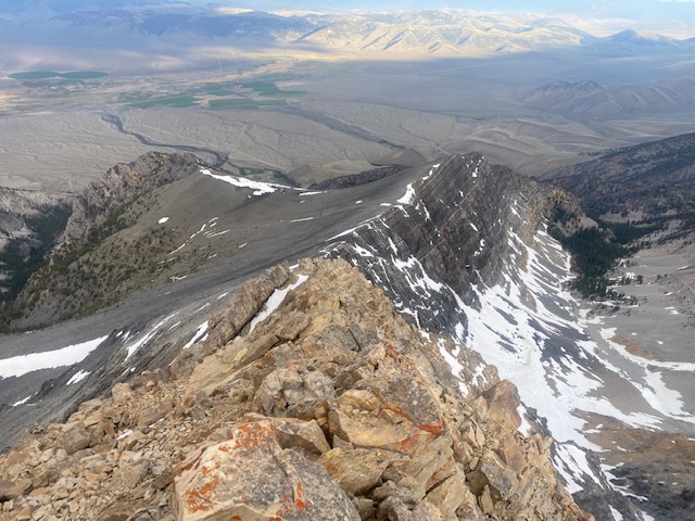
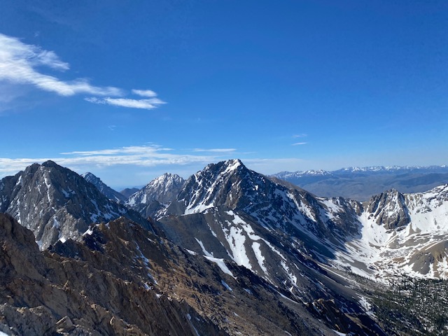
After Chickenout Ridge there is a straightforward traverse to the summit. The views the entire way were gorgeous. The Lost River Range of Idaho truly is a hidden gem. Mt. Borah gets all the attention, but there are dozens of difficult, off-trail summits here. I hope to return someday.
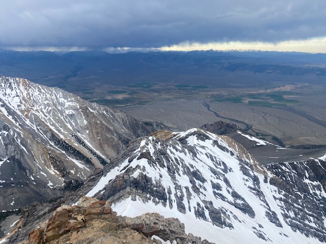
During this time, it looked like a storm would come in. It was well in the morning, so it wasn’t an afternoon thunderstorm. But, the weather moved in all the same. Visibility dropped, it was gusty, and there was some hail coming down.
I thought about turning around, but I decided to continue. It’s a ridge-line — navigation is straightforward. I’d be fine down-climbing Chickenout Ridge if the rock was wet too. It’s only class 3.
What started off as an easy traverse down the ridge-line became more annoying. The ridge-line directly didn’t look like it would go. I’ve also read that one needs to leave the ridge towards the end, traversing low. So, I left the ridge-line and started climbing amongst boulder fields and talus. This was loose and slow-going. I found this more difficult than Chickenout Ridge in fact, where the rock is solid.
While I was traversing these boulder fields, it stopped precipitating — but it was still cloudy and windy.
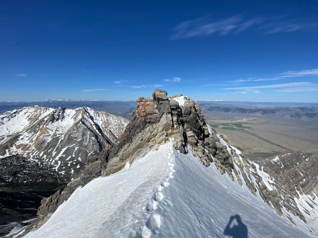
I topped the summit and was blasted by endless gusts of wind. I hung out for only a minute, enough to snap some photos.
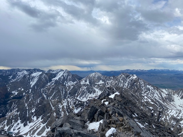
Then, I started descending, reversing my course on the boulders and talus. While doing so, the weather improved, and the sun started to shine. If Chickenout Ridge got wet, it would soon be dry now. Great.
I reversed my course, down-climbing Chickenout Ridge — which went by quick. After that, the return is on a sort-of-loose, very steep trail. That made the descent really quick, and before I knew it, I reached my car.
Though it was early in the day, another person was here planning to climb Borah the next day. I shared some beta and photos of the ridge, and then made my way. After this, I drove back to Bend, Oregon passing through Stanley, Idaho — an absolutely gorgeous, secluded drive. Idaho really is under-rated.