
This weekend was a tricky one. The stormy spring brought precipitation and bad weather almost every day. Saturday’s forecast was better, but it still called for clouds and some rain.
I decided not to do a high volcano, and instead something obscure and lower elevation. My plan was to go tour the North Face of Mt. Watson on Saturday. As I drove on Baker Lake Road on Friday evening, the weather was better than expected. I could see peaks through the clouds. The clouds were nothing more than a thin layer at 5,000 feet. I reckoned it would be clearer above that.
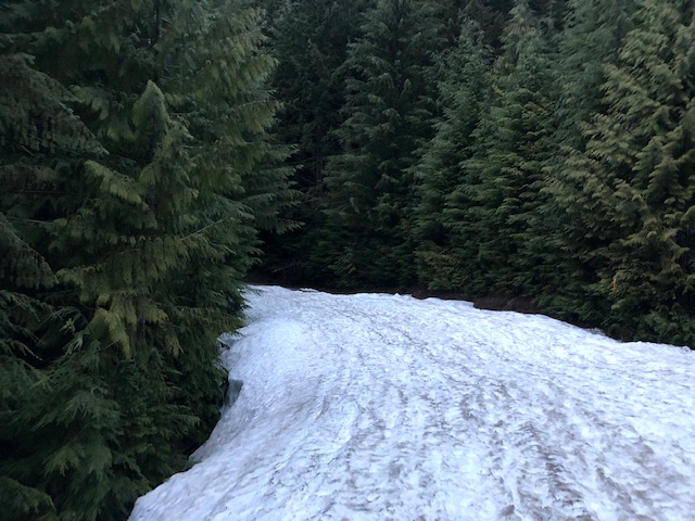
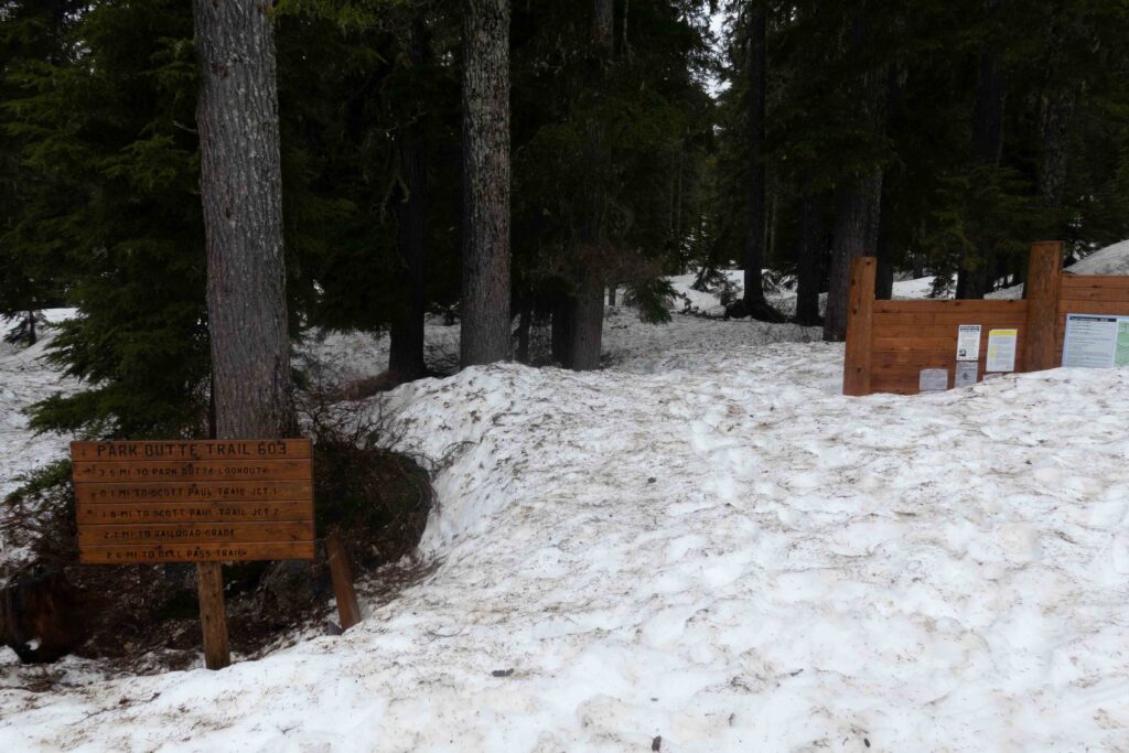
With better weather, I chanced it and took the turn-off to Mt. Baker. The going was tough on my heavily-laden truck. Deep, muddy potholes were everywhere. I was able to drive until two miles before the Park Butte trailhead. From there, deep snow was blocking the road.
The trailhead was packed. I didn’t expect that given the bad weather. It must’ve been because the road to the north side of Baker — for the Coleman-Deming route — was washed out. Now the south side would be getting twice the traffic.
I parked behind a long line of cars. I scouted ahead, wanting to figure out where the snow became continuous. I spoke to a snowmobiler. He said the snow was great. I walked up the snowy road, and after a mile, the snowpack was indeed continuous. There were great views of a nearby range through the clouds as well.
I returned to my truck and began packing my bag and cooking dinner. I remarked to someone about the crowds, and he said, “There are 40 Mountaineers coming tomorrow too for a crevasse rescue class.” Dear God. How much traffic could this trailhead take? I was beginning to regret my decision to abandon Mt. Watson.
I planned to solo the glacier and wasn’t concerned. The Squak glacier is safer from crevasses, and with the above-average snowpack, was full to the brim. I’d be on a splitboard too, with the absurd amount of flotation it provides. Nevertheless, I packed extra emergency gear with me — a stove, harness, crevasse kit and more.
The forecast called for it to be cloudy the next day. I decided to get a 5 a.m start. With cloud cover, the snow wouldn’t change too much over the course of the day.
When my alarm woke me up, it was raining heavily. Darn. But after eating breakfast, I stepped out, and the rain immediately stopped. I started hiking up, and after a mile, got to continuous snow. I switched to my splitboard and began to skin. While doing that, I came across a group of people descending. They started their one-day push earlier that morning, but they only made it to 4,000 feet. The weather was really bad; white-out, sideways precipitation, the whole shebang.
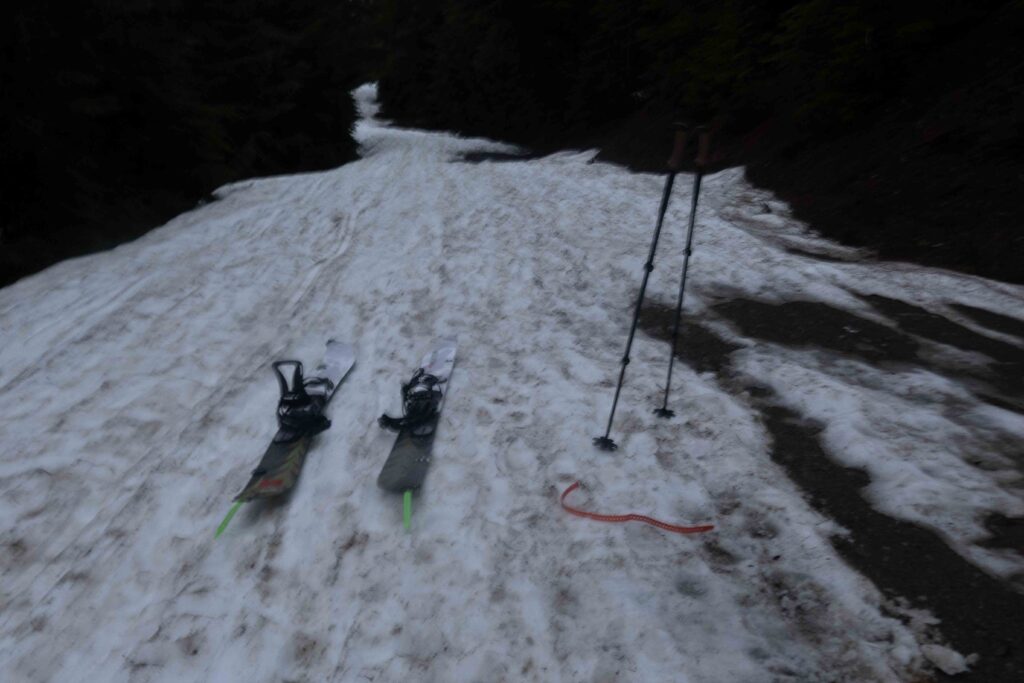
I kept skinning, and I soon reached the actual trailhead. It was buried under a few feet of snow. I came across a few more skiers descending as well. They all said the weather was shit.
To get to the Squak Glacier, I wouldn’t be taking the well-beaten path to the Easton. Instead, the way up is through the trees, sort of following a ridge. I skinned on snowmobile tracks for the first hour. Afterward, it was choose-your-own-adventure through nasty, sun-cupped snow. It was covered in pine needles and other debris too. The grade was steeper here, and my pace slowed as I switch-backed through the trees.
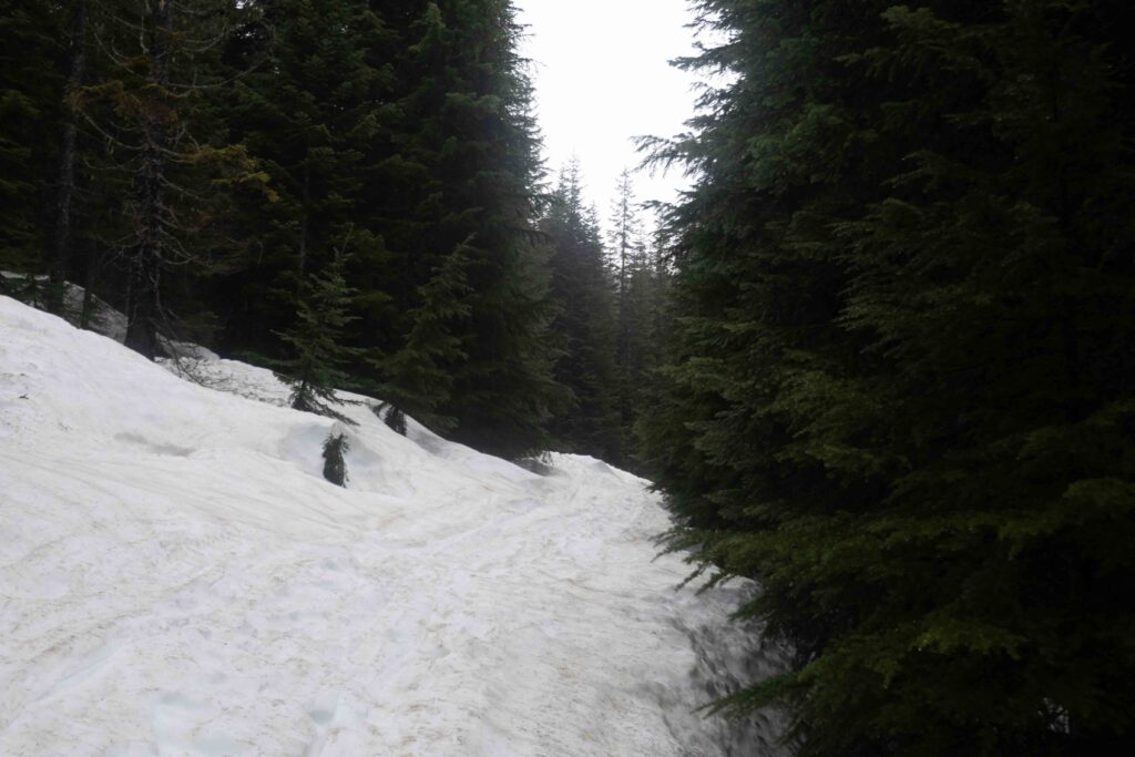
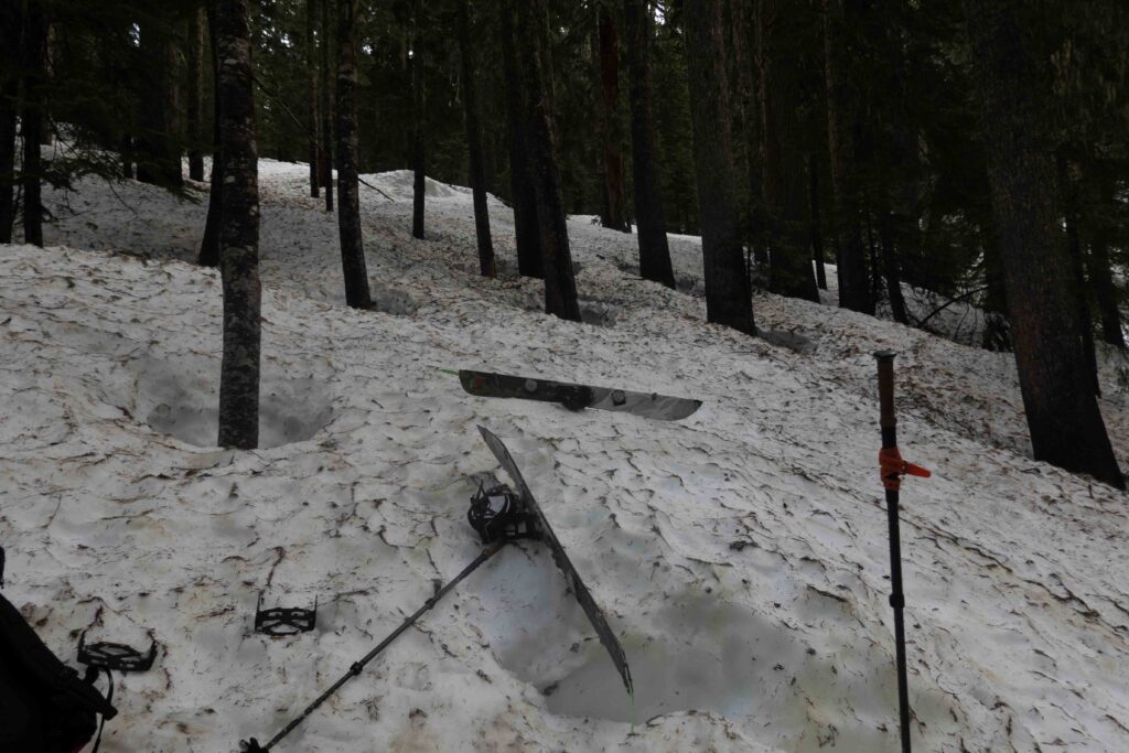
The going became more difficult. I decided to put on my split-crampons. As I did so, I noticed the heel-lift wire from my left binding was gone! The skins were also useless. They were only being held by the tail clip and covered in debris. The weather was holding, but with my gear in this state, I knew my chances were slim.
I decided to keep ascending on foot. I planned to turn around soon, but I figured I could at least get more turns out of this.
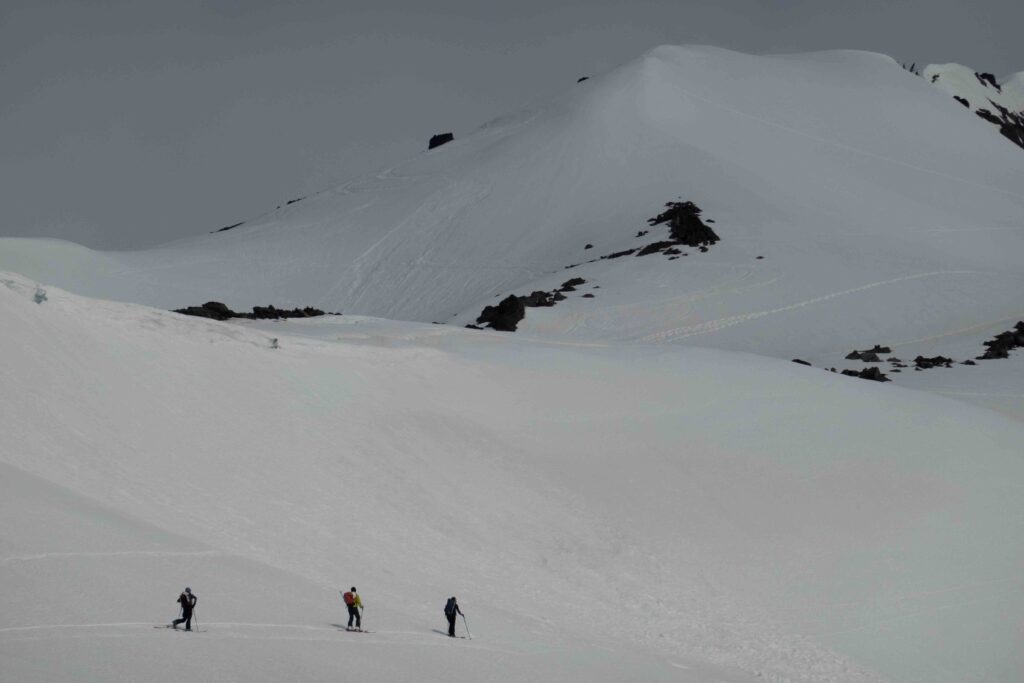
Going uphill, I’d sink with every step. The freezing level was high last night, and it was slow going. I broke out of the trees almost an hour later. At the same time, a group of other skiers began to pass me. I could see the confusion in their faces. Why was this guy post-holing up with a splitboard on his backpack? I told them of my binding problems. They said I could loosen my boot which would help with the lack of heel-lift. I gave that a shot. It was no longer sun-cupped now, and the skinning would be easier with my limited traction.
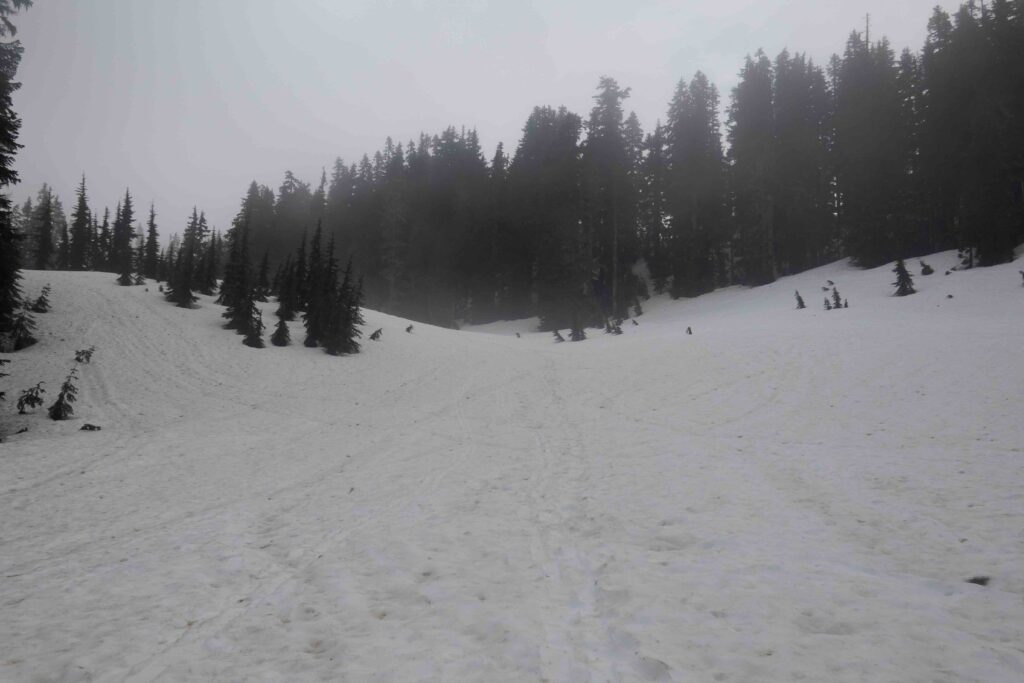
I started skinning again. I had to switch-back heavily to relieve the strain in my achilles tendon, which was stretched on every stride. Despite that, I kept pace with the group, but I was now a few hundred feet east of them. Following the ridge direct worked better for me. It had fewer trees and more uniform snow.
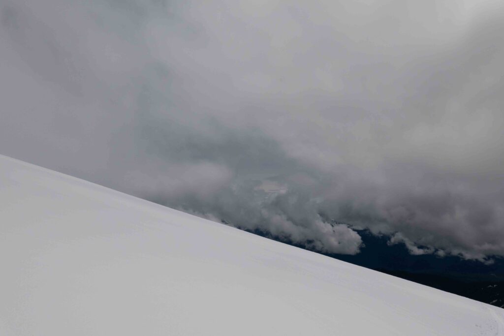
At this point, the weather looked like it would turn. I was skinning through clouds. Visibility was low, and the air was misting. When it seemed like I’d have to turn around, I broke through the cloud layer. Just as I’d haphazardly predicted yesterday, most of the clouds were around 5,000′.
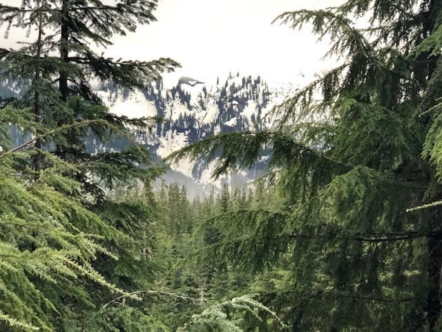
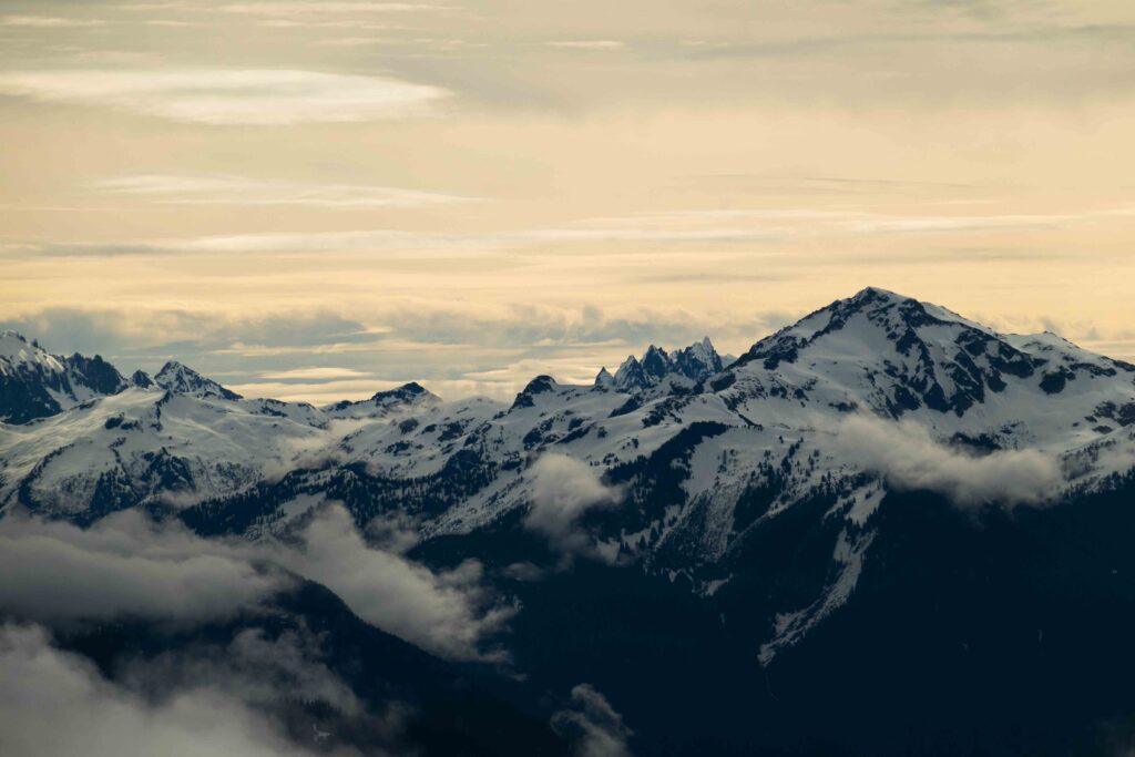
When I broke through the clouds, I was on the east side of the ridge. Stretched before me were the entirety of the North Cascades. Rugged, glaciated summits rising from a sea of clouds. They had their winter coat on thanks to the stormy spring. Most apparent was Mt. Shuksan, the Picket Range, and the elusive Glacier Peak. I stopped ascending and admired the view.
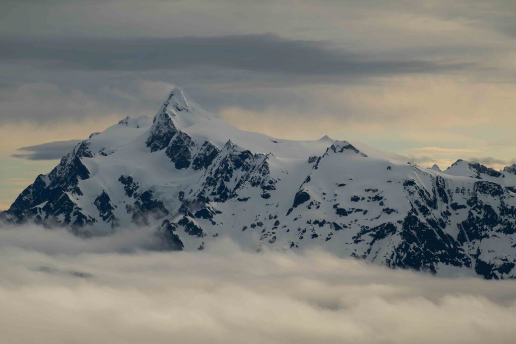
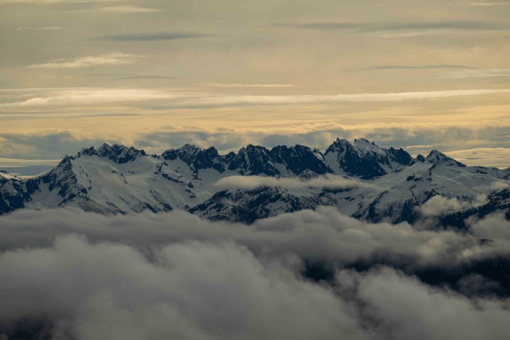
I was glad I took a chance with the weather. Views like this aren’t possible during high-pressure days. Clouds make everything more interesting.
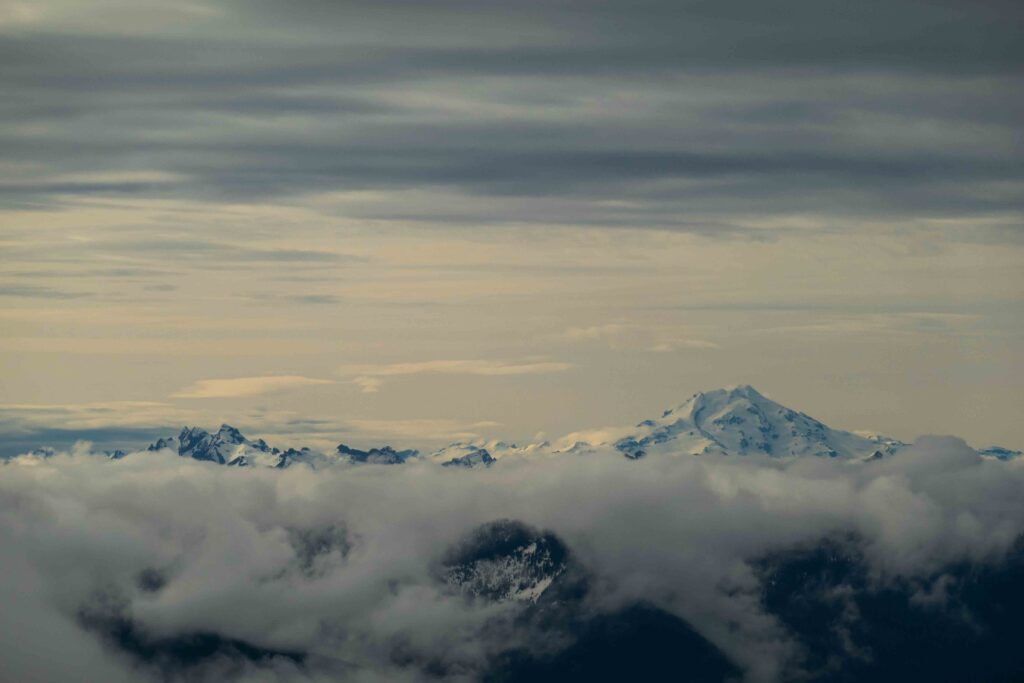
Mesmerized, I took a nice long break on a saddle with the North Cascades to my right. I took off my skins and dried them out. I brewed a cup of coffee too and sat there sipping.
It was sunny now, and Baker’s Sherman Peak was fully visible. I couldn’t use the weather as an excuse anymore, and I decided to get a move on. My avalanche radar was on too. All of this snow was pretty new, and the peak was getting an unexpected sunny day. The freezing level was pretty high that night too.
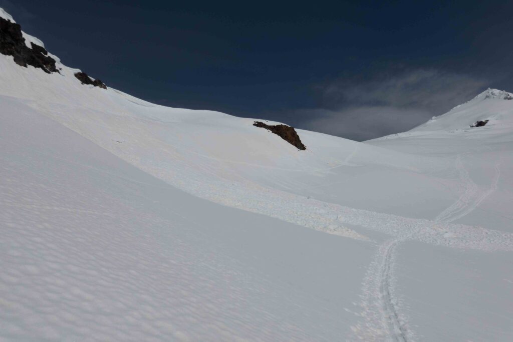
I started skinning again and the snow was already saturated with water. Wet slides were a real possibility. This part of the ascent became a traverse past the now-steeper ridge-line on an eastern aspect. There were a few recent slides, caused either by warmth or cornice collapses. While most of this lower-elevation part of the mountain had already slid, I kept an eye out and stayed far from those slopes.
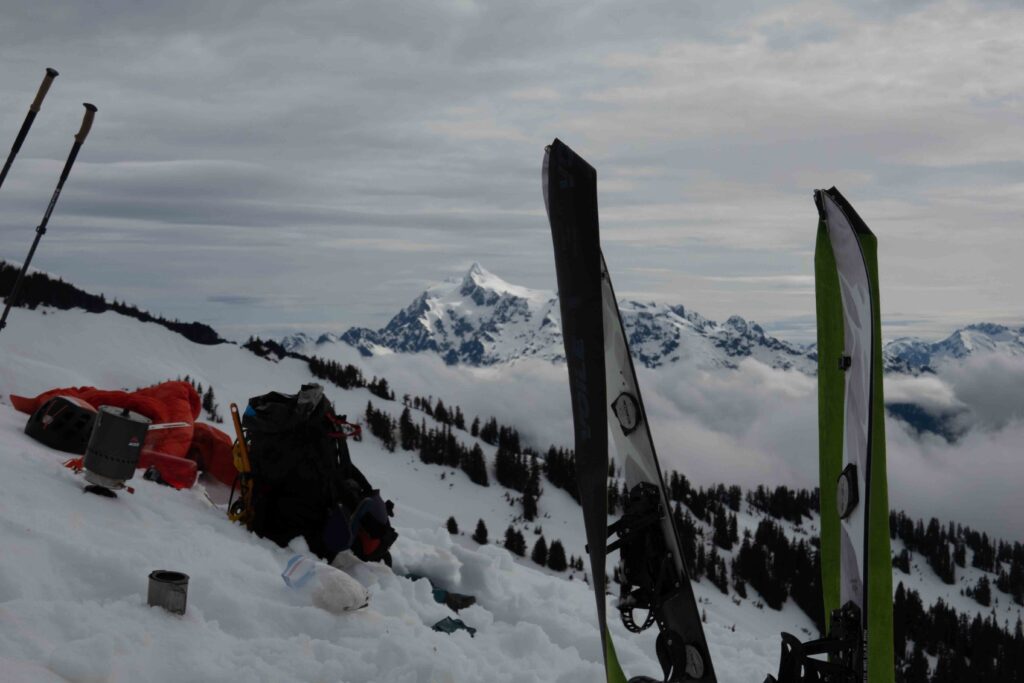
I harnessed up just below the glacier. I racked ice screws, slings, prussiks and a cordelette. If I were to fall in a crevasse — even with a splitboard on deep snow — I could aid myself out. Regardless, the glacier was more filled-in than any of the photos I’ve seen. It’s like winter was a season too late. I meandered up with confidence.
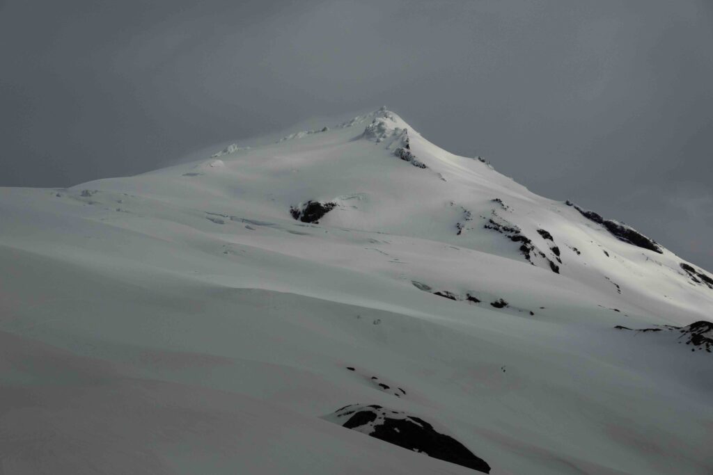
The next few hours were hot and slow. The sun was getting stronger. The wet snow was miserable. My split-skis were heavy from the skin absorbing the water. With the snow conditions, I decided the Roman Wall would be too much risk, and to only go for Sherman Peak if I made it up. That’s the second summit of Baker. The route there is a straightforward ridgeline from the top of the Squak Glacier — safe from avalanche danger.
My achilles tendon wasn’t happy as well. I have a flexible ankle, but all this uphill skinning without a heel riser became painful. It was almost noon, and I started to time my pace. I found I was ascending at a mere 750 feet per hour. At that rate, I’d summit between 3:30 and 4:00 p.m. I couldn’t tolerate that much pain and decided to turn around soon.
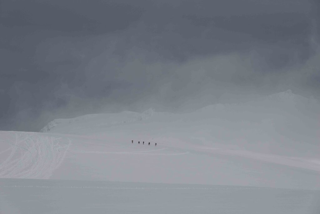
I started skinning west over a sort-of-ridge on the glacier. I wanted to get a view of the Twin Sisters Range and the rest of Baker. As I began to round over the glacier, I heard snowmobile engines.
The day after this would be the famous Mt. Baker Ultra-marathon. It’s a race from Concrete, Wash. to the top of Sherman Peak and back. There’s an interesting history behind it. It was the first organized “adventure race” in the U.S., first done in the early 1900s.
Snowmobilers were zooming up and down the Squak Glacier. They were installing fixed lines and laying a racetrack on the snow. It was an interesting feeling. I was halfway up a pristine glaciated volcano, and smelly snowmobiles were revving by. I can’t complain though, it’s not like the Alps with their gondolas. This was a one-time exception for the race — they’re normally not allowed past the lower slopes of Baker.
Now I was at 7,500 feet and made this my turn-around spot. I probed the ground beneath me for crevasses. Satisfied, I took off my splitboard and began to transition. I brewed myself a cup of hot chocolate too, and sat, sipping, as clouds moved in. Seems like the good weather for today would break after all. As clouds engulfed the mountain behind me, I rode down.
The snow was literal slush at this point, and I slipped a few times as it wouldn’t release my edge. I shifted my technique and rode in the backseat, keeping a flat base and my edges above the snow. That did the trick, and I surfed down the glacier.
At the end of the glacier is the long traverse beneath the ridge-line. As I traversed, wet loose sluffs released below me. It was never a concern though. This was low-angle and just the top of the snowpack, the part that had turned to slush. Beneath was more solid and unreactive snow. The terrain and small cornices overhead were the main concern, so I zoomed by quickly.
After traversing, I needed to take off my board and climb 100 feet to meet the descent route. It’s hard enough to hold a traverse on a snowboard as it is, much less in slush. This was miserable. With each step, I’d sink to my knee. Eventually, I met the ridge-line, and it would be a straight shot downhill to the trailhead.
I started to descend lower angle snow and reached treeline. When I entered the trees, my board stopped moving! The topography was also variable and undulating. Whenever the slope angle was less than five or ten degrees, the board wouldn’t have any glide. I’d have to muscle it forward, and even unstrap my rear foot and kick downhill. If could manage to glide, I couldn’t change an edge. Once my base would touch the snow it would be like slamming a bicycle brake. I’d be pitched forward.
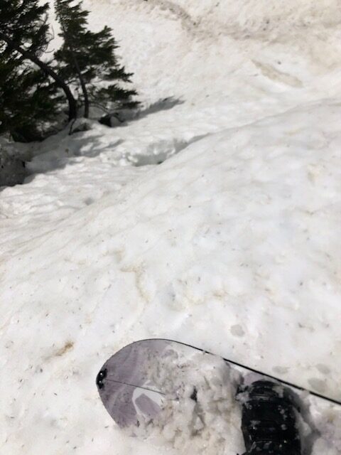
I had no clue why it was doing this. Frustrated, I unstrapped and looked at the base, assuming it was completely destroyed or something.
The base was covered in something sticky. Whatever that sticky material was; it had caught dirt, pine needles and snow in it. My entire base was a disgusting, gummy, mess. I had almost 2,000 feet of descending to go. I certainly wasn’t going to walk it. I took the tiny scraper which came with my skin wax and started scraping. 15 minutes of labor later, my base was acceptable.
I started descending again, with much better glide. But, the problem returned after just a few hundred feet. What the hell. I had lost my scraper as well, and even if I had it, it would be ridiculous to scrape the base every few hundred feet.
I persisted, and soon enough I figured out how to ride like this. I’d have to walk a few sections with flatter topography, but when it was steep, I’d stay on one edge as long as possible. When I had to change edges, I’d either do a jump-turn or keep weight on my back leg. I did this, dodging trees and bushes the entire way. My speed was laughable.
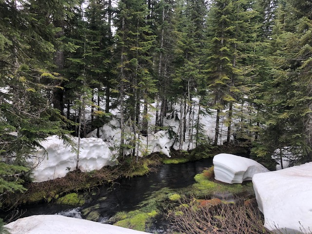
I eventually found my holy grail — a drainage. I checked my map and this led straight to Park Butte. It was free of trees. Best of all, it had steep sloping walls. I could stay on one edge the entire way and not deal with the hassle of turning.
I followed the drainage, sometimes staying on a single edge for minutes at a time. I came across a rollover. Unassuming, I continued and fell into a crack in the snowpack. It was maybe five feet deep, and I heard a trickle of water underneath the snow. I managed to muscle my way out without unstrapping and continued descending.
A moment later, I came across another rollover. I wised up and I stopped right above. Below was a small waterfall and a little “crevasse,” A fall there might have brought me underneath the snow. The snow in the drainage was at least 10 feet deep, but all the slush on the Squak glacier was draining here. It was eroding from underneath — rapidly. It’s extraordinary how much this landscape changed over a single day. What I did not want, was to end up inside that landscape.
If I was smart I would’ve left the drainage. But, the way ahead looked tempting. I figured I’d follow it as long as I could until it got worse. Which it did. I came across another rollover. I stopped above, and below was a roaring waterfall and a crumbling snowpack. The walls were much higher now, and the drainage had become a gorge.
I knew I was in for a slog now. I had to leave the drainage up these walls. I unstrapped and then boot-packed 45-degree snow for 200 feet to escape. I was post-holing the whole way up. After that, another 100 feet of ascending brought me back to the ridge.

I strapped in and started descending again, aiming to stay in the trees. However, the topography was bringing me back into that drainage. I had to stop and traverse on foot for 15 more minutes to completely leave its fall line.
Some more rough descending later brought me to a different drainage. With a compromised snowboard I was at the mercy of where the mountain sent me. I didn’t have enough glide to not follow the fall line.
At this point, I unstrapped and traversed once again, wasting God knows how much time in the process. I tried to ride again, but 100 feet later, it was too flat to ride with my frictioned-up base.
This was when I relented and strapped my board to my backpack. It was a few hundred feet of descent to the road. I had to bushwhack in some parts, but it wasn’t as bad as the rest of the Cascades. The snow was deep and the trees were better spaced.
I was miserable. Brush and sweat covered me. I was tired beyond all recognition. I’d spent hours trying to ride through these trees, muscling my board in every direction. My pants were soaked from the slush. My ankle, stretched by hours of skinning, was killing me. This was firmly in the type-two category.
If I had walked and not tried to snowboard I would’ve been in Bellingham by now. Instead, I got 1,500 feet of the suckiest riding ever.
I broke through the trees and was almost at the road. There was an unexpected creek blocking the way. It wasn’t marked on my map. This was just great. Another obstacle to add to my misery.
I bushwhacked until I found a suitable spot to cross the creek. I crossed it on some fallen logs. A little more thrashing later had me at the road. Now, it was 1.8 miles of walking to get to my car — which would at least be easy.
I ran into another group of skiers on the walk back. They didn’t summit on the Squak either, thanks to the slow and slushy snow. They mentioned their bases were sticky as well. I originally blamed my skin glue, but they mentioned it may be pollen or tree sap. That must’ve been it, we can’t all have lost our skin glue on our bases.
That group’s descent route was towards the Easton, where they rode down open moraines and reached the climbing trail. That seems like the better way, rather than following the ascent route — beta for next time.
I reached my truck. I was ravenous, only having eaten a couple of granola bars all day. I ate some dumplings. Then, I washed those down with milk and cereal. After eating, I hung my wet gear around the truck to dry. With no home to dry out gear, the trailhead often has to do.
I spoke to a few groups, and nobody summited except for one. They camped the night before, and persisted in post-holing up the Easton Glacier. One of them even fell waist-deep into a crevasse below the Roman Wall. Nevertheless, they made it up, and descended with variable visibility, following their boot-pack.
As the guy yesterday said, the group of 40 Seattle Mountaineers made their appearance. They marched back to their vehicles in a massive swarm. I’m all for people enjoying the outdoors, but come on. A group of 40 is ridiculous. Imagine having to pass that many people on a narrow trail.
An hour or two passed and my gear was drier. I packed what I could, and whatever was still wet I hung in the camper. I turned on my diesel heater and set the roof vent to exhaust, which would dry the remaining gear out.
I cranked the engine and started driving, dodging potholes on the miserable road back.