
We set off to the Inspiration Glacier region for a two-night trip. We had the goal of tackling Eldorado, Dorado Needle, and Klawatti Peak. A few days before, I suggested we could tack on Austera too. Four peaks, involving three technical rock climbs, all in one trip? That would’ve been great.
Unfortunately, trips into the North Cascades National Park involve permits — even for high alpine climbs like this. My research showed that there is enforcement here. So, we decided to go through the hassle.
We spent the night before at a free site a half-hour from Marblemount. The morning of, we woke up and grabbed breakfast at a coffee shop in Concrete. Then, we drove to the Marblemount Ranger Station and found it a mess of people. Surprising, given this was a Thursday.
I stood in line for 10 minutes, only to find out that we needed to grab a ticket. I grabbed a ticket and waited for 10 more minutes. Then, we finally got to meet with a ranger. She gave us a Ursack bear bag, even though we’d be camping high up on the glacier. At least it was light. If we needed a bear can, we’d have no place to keep it.
We got to the Eldorado Creek trailhead. It was steaming hot — there was a mini heatwave this day. We loaded up our over 45 lb packs. We had to schlep up two nights of food and fuel, a rock rack and shoes, and our mountain boots and glacier gear.
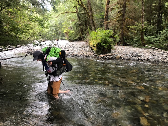
We searched around in case we could log-hop the river crossing. We couldn’t find any, so we removed our shoes and waded through. It wasn’t bad, but we didn’t pick the best spot. If we fell, the rocks downstream would’ve injured us.
The trail through the trees began to go straight uphill. It was tiring with our heavy packs, but we made efficient progress. It was like the trails of the Adirondack High Peaks. Rugged and straight uphill, with lots of rocks and roots.
About 2,000 feet of gain later, we broke through the trees to the boulder field. I didn’t bother trying to get any beta for this approach and instead relied on a GPS track. But it would’ve been too annoying to check a GPS our entire way up, so we followed the “path of least resistance.” We didn’t find that, and we scrambled our way up without finding a use path at all. Our progress slowed, especially with the weight of our packs.

During this half of the approach, temps were in the 80s and it was humid. We were sweating buckets and drinking tons of water. We only brought pants too, and they were soaked with sweat.
We continued up the boulder field, off route. Towards the end, we had to traverse 45+ degree heather slopes. Ben slipped and slid once. I almost did too — but a handful-of-heather self-belay saved me.
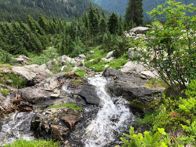
After this section, we reached a well-defined trail. Right at this point, there was a running water source. It was just in time too, as I was out of water. We filled up and continued.
The remaining 1,000 feet was on a less-steep trail cut through the dirt. We breached timberline and reached a gorgeous mix of granite and meadow. The trail here was well defined.
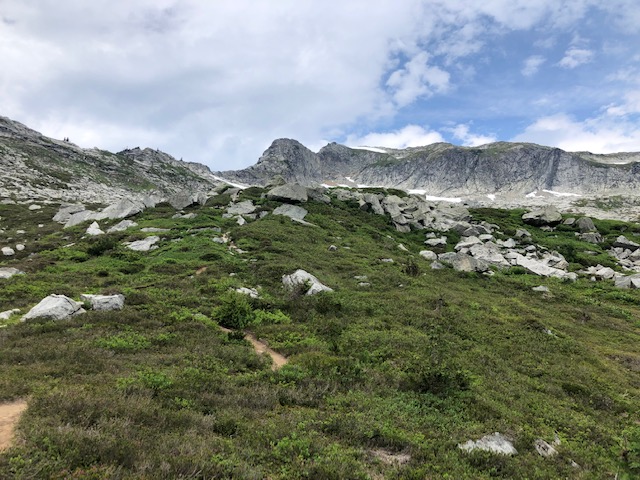
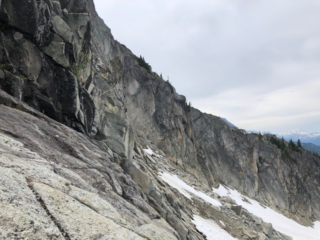
Near the end of the granite meadows, we had to cross the ridgeline climber’s left. We did some easy scrambling up, following a faint use path in parts. Then, we found the correct place to cross — a 100-foot-tall class 3 to 4 cleft cut into the cliff.
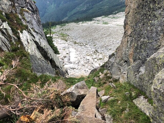
We downclimbed the cleft and the glacier appeared in front of us. It would be intermittent snow and rock for a few hundred vertical feet. Then, it would be smooth sailing on the glacier.
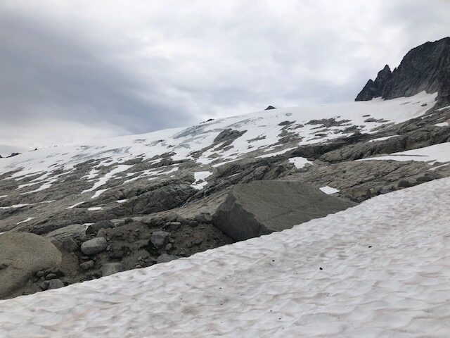
We traversed a few snowfields, staying on the right side of the basin. We switched to our mountain boots a few hundred feet in. The snow was quite hard up here.
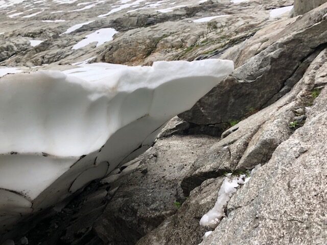
On the largest snowfield, a moat guarded our access back to rock and the glacier. I saw a spot from my vantage point where the moat appeared to have the smallest lip — no more than a foot or two deep.
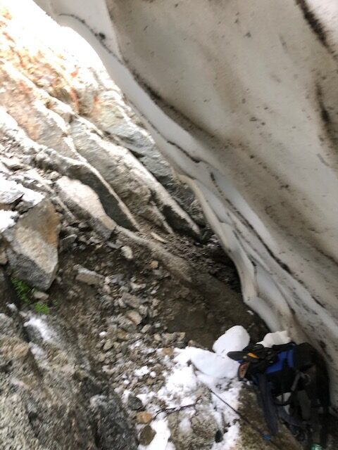
I approached the edge of the moat. I started to use my ice axe to chop away the lip. I wanted to expose solid snow or rock so I could cross over safely. Suddenly, the entire section of snow I was standing on collapsed! I fell 10 feet before hitting rock. Then, I slid 10 – 15 more feet. At the last moment, I turned my backpack against the moat to absorb the impact.
Somehow, I was unharmed. My partner was above yelling if I was ok, and I was. How I didn’t smash my helmet-less skull against a rock is a mystery. The terrifying part was how large this moat was. It overhung at a sharp angle for at least 15 horizontal feet. We couldn’t see it from above.
From my position inside the moat, I could see a spot where it would be safe to cross — about 30 feet downhill. I told my partner to cross there, and I set to climb out.
The climb out of the moat was loose and wet fourth class — pretty tough with a heavy pack and mountain boots. After escaping the moat, I made another mistake. Traversing looked wet, so I thought I’d continue higher up and find a route around. In hindsight, I should’ve stayed in the moat and traversed from down there.
I climbed up 20 feet of loose 5th class. Higher up, it looked worse. Shit. Well, there’s no way I was going to reverse those moves. I didn’t have a rope on me either. Ben had the rope, I had the rack.
Up there, I turned on my radio and started communicating with Ben. He was out of sight and hadn’t heard from me in 15 minutes. I saw that the only way out was granite friction slabs. Without rock shoes, I would’ve insisted Ben throw me down a rope. Thankfully, I’d packed them for the climbs we planned the next day
I switched to rock shoes and started soloing on Yosemite-style friction slabs. I was glad I climbed there recently because this would’ve been dicey otherwise. I traversed over on secure smears. I finally reached him. I saw what I was trying to climb up and it was a series of cliffs — hard to get to from above. A dumb mistake.
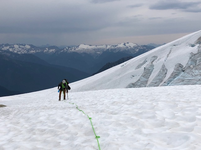
We continued on easy 3rd-class slabs before reaching permanent snow. We switched to glacier travel mode. We were thankful — after putting on harnesses, crampons, the rack, and the rope — our packs were much lighter.
The first part of the glacier was at a moderate grade, and we gained a little over 1,000 feet here. On the way up, we crossed by a small serac or icefall.
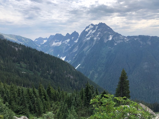
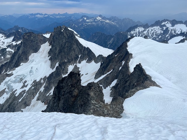
We soon broke across a hump on the glacier and saw the East Ridge of Eldorado — our campsite. The glacier was flat till there, and we traversed. There were no crevasses on our route, but there were plenty above and below us.
Unfortunately, Ben was battling some issues of his own. He either had a stomach bug or dairy issues. We likely wouldn’t be able to do the technical rock climbs. But, with our campsite near the summit of Eldorado, he decided he’d push and try to climb that tomorrow.
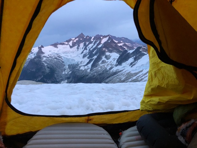
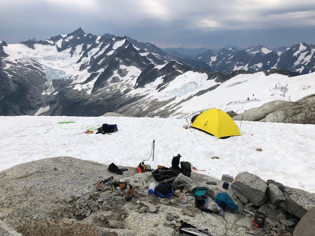
There were two other parties camping that day. One group of six, and a group of three. They had most of the dry campsites. But, I found a perfect spot on the snow with a great view of Forbidden Peak. I spent a half-hour chopping and stomping a tent spot.
There was running water and Ben filtered a couple of liters for us. Then, we cooked dinner and went to sleep.
Our alarms were set for 4 a.m. When we woke up, it was drizzling outside. Darn. But, I’d rather have rain than oppressive heat. It did mean our rock climb plans wouldn’t go however.
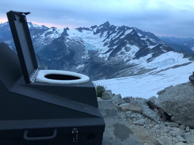
We decided to sleep in until the rain stopped. At 6 a.m., it did. We woke up, ate some breakfast, and prepared to summit Eldorado. I also made a trip to check out the backcountry toilet. It was sublime. Nothing like relieving with a view.
We switched back to glacier travel mode to ascend Eldorado. As we did this, the rain came back. I guess the rock wouldn’t go on this trip. Ben wasn’t feeling good either. But, he was well enough to summit Eldorado and we’d get a summit out of this trip.
We started to ascend the glacier, remaining a hundred feet north of the ridge. About 500 vertical feet later, we came across a few gaping crevasses. End-running them would’ve taken a while, so we decided to ascend the ridge.
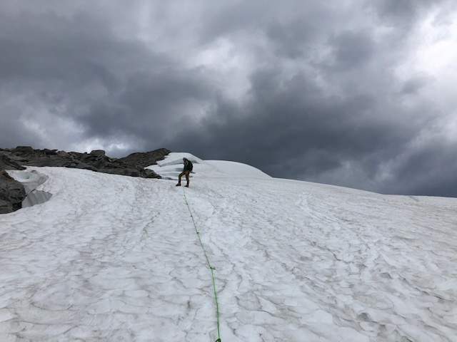
We met the rock of the East Ridge, shortened the rope, and took our crampons off. We scrambled up a few hundred feet of 2nd/3rd class until we were past the crevasses.
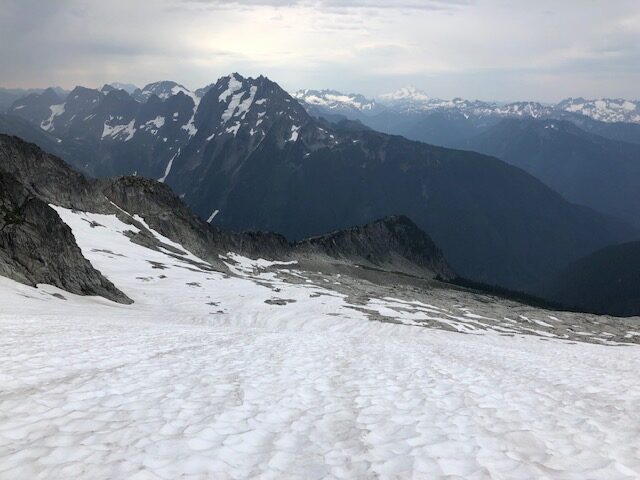
We returned to the glacier and started climbing to the summit. The “knife-edge” was cool, but nowhere near as daunting as the pictures look. Only the photo angle makes it look like that. The ridge traverse on Mt. Hood is significantly more “knifey”.
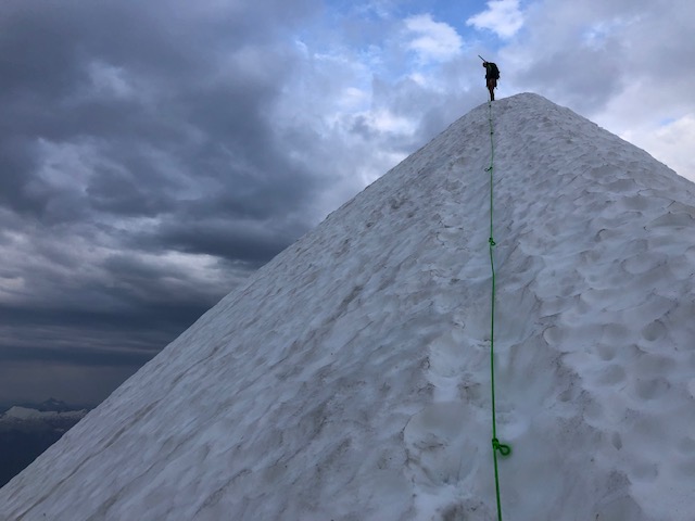
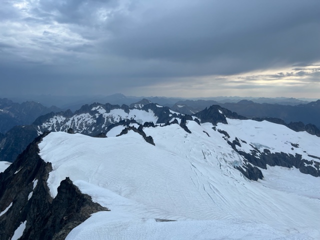
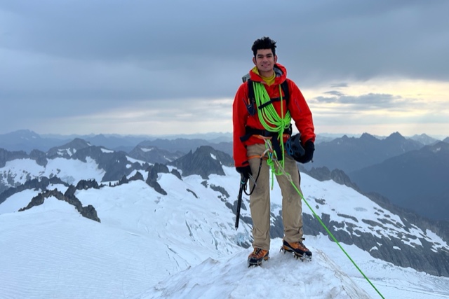
We reached the summit right as the rain stopped. The views were phenomenal, and the clouds made them that much better. I’d take this over a sunny day anytime.
We took our summit photos and started to descend. We reversed our ascent route. It was a good exercise in rope work, as we moved from snow to rock and then snow again.
The rain was intermittent, and even if Ben wasn’t sick, the rock climbs would’ve been dicey with wet rock. We decided to descend and we packed up camp.
We shouldered our heavy packs again. We reversed our course down the glacier. First the traverse on the glacier, and then consistent downhill until granite.
We left the glacier and reached the granite slabs again. The moat I fell into was as gigantic as I remembered. The most impressive thing was how strong it was. I was standing on snow no more than six inches thick. Only the thwacks of my ice axe caused the moat to break.
At the granite, we packed our glacier gear but kept our boots on for the snowfield traverses. We then reversed our approach. We met the ridgeline again on intermittent snow and rock. At the base of the rock cleft, we put our trail runners back on.
After scrambling up the rock cleft, we stuck to the trail for the descent. The trail was a lot more defined than we remembered. It’s a lot easier to stay on the correct course when descending. We could see the trail far ahead of us with tons of visibility. When we ascended, it was the opposite.
Then, we reached the dreaded boulder fields. It wasn’t as dreaded as we thought. There was a rough but usable trail through there. We continued down, with less scrambling than before.
We reached the trees, and 1,800 feet of descending brought us to our cars. The Cascade River was running heavier thanks to the rain. But, we found a shallower spot to cross. We made it without issue.
We checked our time: 5 hours from our camp to the cars. That was with me slowing Ben down too — I elected to keep my knees happy. Not bad though, especially with having to transition so many times. The steep trail makes for efficient downhill travel.
We got back to the car. Thankfully, the windows weren’t smashed. Washington has gotten sketchier, and the rangers warned us about recent break-ins here. It did help that we parked next to campervans. They would have a lot more valuables.
Satisfied, we drove back south. A disadvantage of our early departure — Friday traffic on I-5. Oh well.