2021 was surprisingly decent for New England ice climbing. Numerous freeze-thaws and rain events left the snow in poor shape, but the ice was fat because of that. This was the first weekend of April, and we decided to go for Pinnacle Gully in Huntington Ravine. It’s an ice gully in a rock cleft in Pinnacle Buttress. It goes at three pitches, WI3.
The weather for this weekend wasn’t great but we were committed. We decided to go Friday when the weather was worse rather than on the weekend when the ice might be worse. Bad weather and New England ice climbing go hand-in-hand anyway. The drive from Boston to Pinkham Notch was in the pouring rain. When we got to Pinkham Notch, it became moderate freezing rain. Just wonderful.
We marched up the Tuckerman Ravine trail. This was a Friday morning and the weather was terrible. We didn’t see a single person on the trail. Nobody was there. For once, Mt. Washington was empty.
After about 2,000 feet we reached the turn-off for the Huntington Ravine fire road. This takes you to the base of the ravine. 0.3 miles up this brought us to the Harvard Cabin, where we rested for a bit. We were pretty wet and glad to have a roof to dry ourselves out.
We watched the freezing rain ice up the branches outside. Eventually, it stopped precipitating. We started moving.
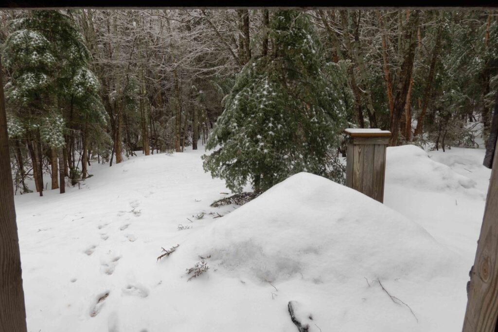
On the way up it snow-showered for a bit. Besides that, the weather was much better. We worried about falling ice though, it was the end of the season after all.
We broke out of the trees and reached the boulder field at the bottom of the ravine. We put on crampons and took out our ice tools here. We marched up and began following Central Gully. A few hundred feet up Central Gully is the start of Pinnacle Gully.
In Central Gully, I saw a pair of roller-ball tracks that looked exactly like ski tracks. I was about to remark “Why the hell wasn’t this guy making a single turn,” until I realized it was a small slide. It was a sign of deteriorating conditions as well.
We reached the bottom of Pinnacle Gully, and it was a bowling alley. A constant stream of icy debris was zipping down. Most of it was small and soft, no more than grape to plum-sized. I did see the occasional calf-sized chunk however.
At the base of the climb, we racked up and discussed if we should give it a shot. The ice was in full “hero conditions.” A single swing gave you a bomber stick. The only problem was the constant stream of ice-fall.
After staring at the gully shower debris for 20 minutes, we decided not to climb up and instead go for O’Dell’s Gully. That’s one route South and it goes at WI2+. We descended, and then traversed over and then up O’Dell’s.
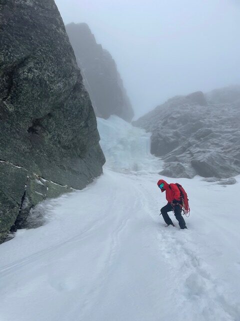
O’Dell’s gully was dropping debris too, but it’s not steep enough for most of it to be airborne. The center of the gully was a stream of sliding ice and snow chunks. It was quite loud too, a constant “whooshing” sound.
Phillip said that this was actually a weather phenomenon called graupel. The falling ice wasn’t the gully disintegrating. It was ice chunks from the sky falling in the upper mountain, which would then roll down these gullies. Wacky weather for sure.
We climbed steep snow to the base of the ice. I built a belay anchor and Phillip prepared to lead. While organizing gear he dropped his walkie-talkie. We watched, slow-motion, as it slid down the steep snow. It came to a stop, but it was in the path of the falling ice. It would be swept away at any moment.
This was a harrowing situation. We were tied in, so I lowered him down to the device at light speed. We rescued the walkie-talkie just in time, preventing a $100 hole in his pocket.
After those shenanigans, we started climbing. When we reached the only pitch of ice, we both wanted to lead it. In the end, I conceded. It was his ropes after all — but he stole those ropes from the university outing club, but that’s another story.
While he was climbing, a large ice chunk whizzed past his ear, having peeled off a rock pillar overhead. Maybe this wasn’t the best idea. We continued on.
The top of the pitch broke out into some rotten ice and then steep snow. We discussed over the walkie-talkies about the belay anchor, and he built an awkward sitting belay in the lower good ice to bring me up.
I followed up and the ice conditions were fine. Not as hero as Pinnacle gully, but easily climbable nonetheless. This was maybe WI2+.
After the ice I soloed up steep snow, bringing the rope. I found a nice bench right at the end of the rope and Phillip continued up.
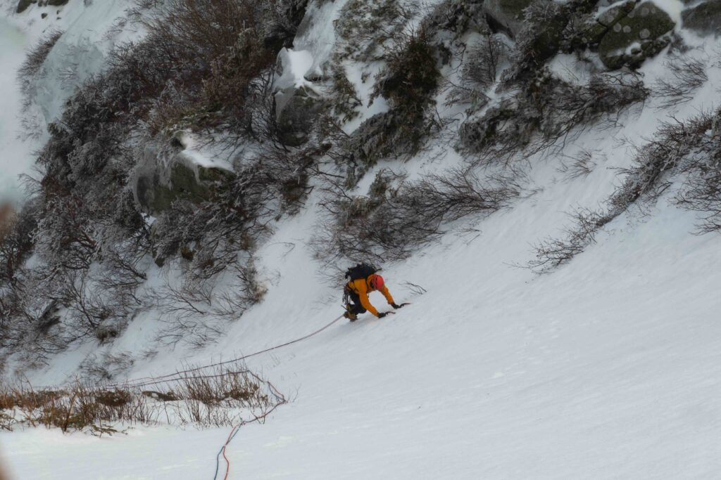
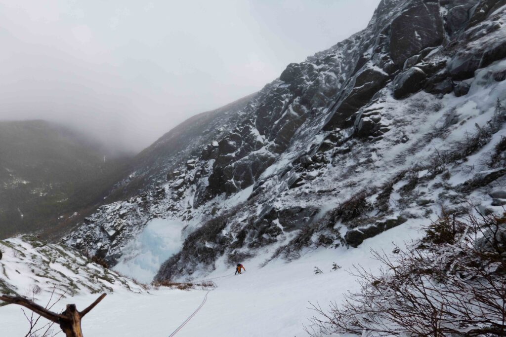
From here, the rest of the way up was nothing more than steep snow. We coiled the ropes and simul-soloed the remaining gully. In the process, the clouds were doing funky things on the horizon. Mt. Washington has variable weather, and here it was in full show. There was even a rainbow at one point.
We reached the top of O’Dell’s gully and it was a white-out. The air was foggy and misty too. I removed my crampons and ice tools — and donned microspikes and trekking poles. We decided to descend via the Lion’s Head Trail. It’s the hiking route on the eastern ridge of the peak. We had the choice to descend back into Huntington Ravine by another route, but there was no visibility and we weren’t familiar enough with those routes. Lion’s Head trail I knew from past winter ascents of the peak.
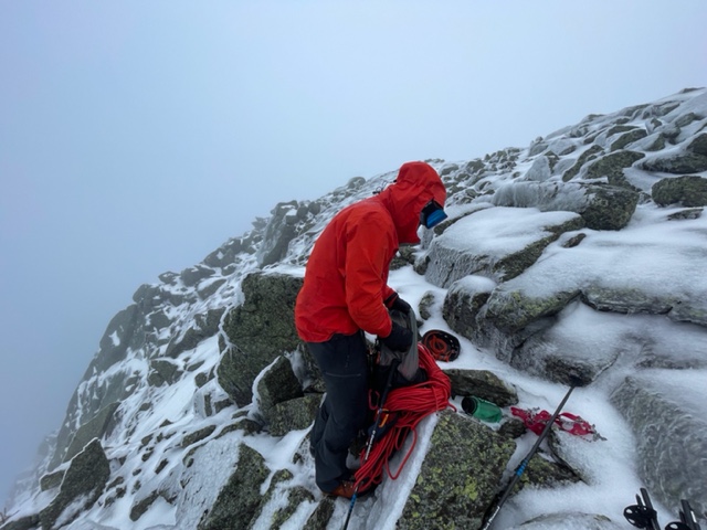
We traversed on the Alpine Garden Trail, which follows the broad plateau below the summit. We reached the Lion’s Head Trail intersection and turned to descend.
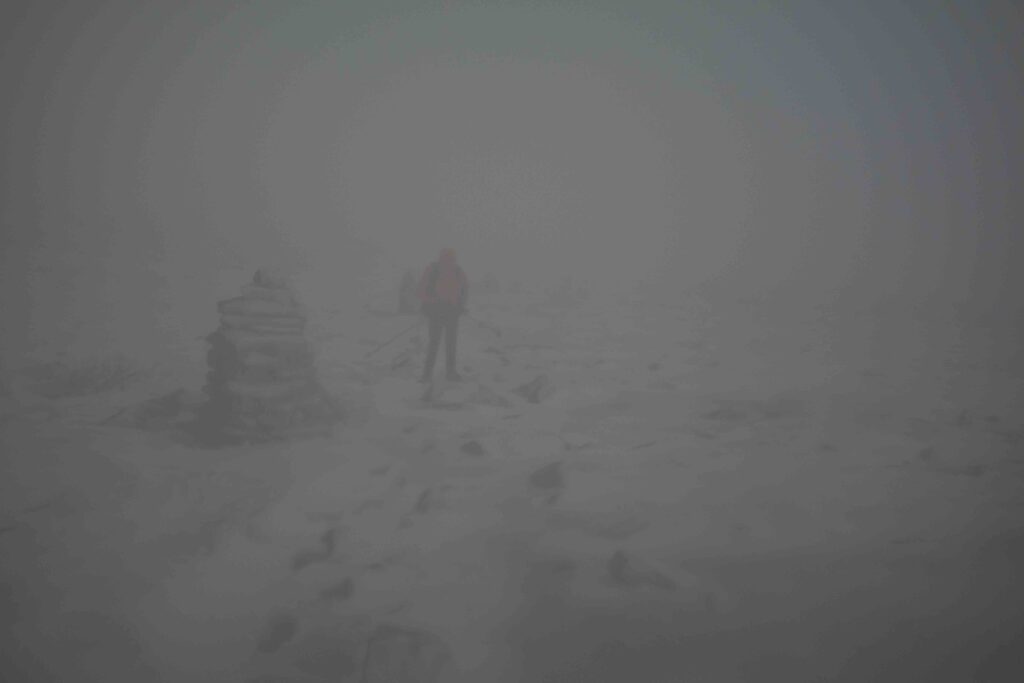
The first 500 feet of descending is on classic Northeast trail gnar. The “trail” is entirely loose blocks and rocks, requiring concentration with every step. This was covered in ice and graupel as well. The going was fun — trails and conditions like these are what make the Northeast so interesting. Soon, we passed the classic Lion’s Head rock formation. That rock formation also marks a drastic change in the weather. As soon as we crossed it, the wind died and we were no longer in the clouds. The topography of the mountain must keep the worst weather above that point.
After the rock formation, the trail breaks out into either the Lion’s Head summer trail or the Lion’s Head winter route. The summer trail is the hiking route, but it passes through avalanche terrain. Because of that, the winter route runs a different course and avoids that terrain. As we reached the intersection, we had two choices. Of course, there were no boot-prints since we were alone on the mountain.
We went the right way and descended for a minute. Just to confirm, Phillip asked me to check my GPS. I checked it, misread the map, and brought us back to the intersection. We switched course and followed the summer trail. We navigated with difficulty through the variable terrain and then saw the rest of the trail would traverse across steep snow slopes — the avalanche terrain. We reversed our course, wasting some time in the process.
The Lion’s Head winter route is the mountaineering route to the top of Mt. Washington. Above treeline, it has exposed rocks and blocks. The snow never remains deep there because the winter winds blow it into the ravines and snowfields. Below treeline — the section we were about to enter — should be uniform snow with one small section of WI1. Depending on the snow conditions, climbers kick steps with microspikes or use crampons to ascend. It’s also steep. To ball-park, the average slope angle is 25 degrees with some sections sustained above 30 degrees.
That’s how the trail should be in a typical winter. This winter wasn’t typical. The many rain events and freeze-thaws destroyed the snowpack. There was also the day’s weather — freezing rain and graupel — which added even more ice.
The easy trail we expected was anything but that. We were in microspikes and trekking poles. As soon as we descended below treeline, we found these atrocious conditions. Our boots and spikes had zero traction on the wet and icy surface. We thought it would improve, and because down-climbing with crampons is so slow we persisted. We descended the first few hundred feet like clowns. We used every tree as a handhold, and took more than a few slides each, only stopped by trees or digging in our boots.
After down-climbing a small section of water-ice with our getup, using trees and roots to self-belay, we thought the worst was over. Then, a few minutes later, an extended section of water-ice presented itself. It was of variable thickness and covered everything. Some of it was from the freezing rain, but much of it must have developed over time thanks to this winter’s weather. Because the snowpack was deteriorating, only this ice remained.
After seeing that we finally transitioned into our crampons and ice tools. We properly down-climbed the ice now. For me at least, it was a little hairy. There was plenty of thin ice you couldn’t trust, and what appeared to be thick was sometimes rotten garbage. We were at a lower elevation now and the weather was warmer, so it was all melting too.
The trail got even worse from here. Phillip called out, “Dude, crampons were so the move!” I’m sure we sound like idiots, having the right gear in our backpack for so long and only now using it. We probably were, but it’s a hassle switching foot-traction, poles and axes. We kept expecting to turn the corner and see the uniform snow we were waiting for.
The crux of the down-climb was a 10-foot frozen and vertical waterfall. This was off the main trail because we saw that the trail devolved into closer-to-vertical mixed climbing. The Lion’s Head winter trail only goes as a winter route, when deep snow covers the garbage and makes it less steep. What we encountered must have been the “bowels” of the trail. Or, the mixed climbing or waterfall conundrum may have been us off-route. Who knows.
After negotiating the waterfall, we popped out at the Huntington Ravine fire road. This was much, much better — a wide, well-trodden path down. We packed our crampons and ice tools, then switched to trekking poles. I forewent microspikes since they’d just ball up with snow, and I prefer descending without them on this easier trail.
We began the 2,000 feet of descending to our car on the straightforward Tuckerman Ravine Trail. By now, the sun was actually shining! The upper mountain was still shrouded, but down here there was no longer freezing rain. And of course, we did not see any other person at all. The mountain was still empty.
Every bridge we crossed was ripping with fresh snow and ice melt. The ravines were deteriorating even faster. Pinnacle Gully, our original objective, does stick around until the end though. It’s hidden from the sun in a rock cleft, but future climbers might need to deal with rotten ice and ice dams when that route deteriorates from beneath. When we got to the parking lot, it was unseasonably warm. Around 50 – 60 F.
Back at the car, we set to manage our soaked clothing. The down-climb and unexpected slides on the wet and icy Lion’s Head Trail left our clothes completely soaked. We didn’t use my truck and camper for this trip, which would have extra clothes. Instead, we used Phillip’s Prius. That saved us over $100 of gas but we had no extra clothing with us. In hindsight, I should have said we should pack some, but I’m used to all my clothes permanently being in my vehicle.
The drive back to Boston was annoying with our soaked soft-shell pants compressed against the car seat. The humidity and smell of our wet boots weren’t great either. Phillip started off driving in his underwear for a bit, but eventually grew some shame and put his pants on. We stopped at a brewery too, and spending time there brought my pants to a more acceptable level.
When we reached Boston he dropped me at my truck. I’d parked in front of his apartment complex to make the early-morning drive easier. The university gym was a convenient 10-minute walk away, and I showered there to get the grime off. I got to my truck, hung up my wet gear and jackets, and went to sleep — hoping they would dry up by morning.
