
The North Ridge of Conness was such a good climb that I had to come back and do it again. This time would be with a partner, which would provide another perspective on the route.
This trip report will focus more on the trip. For beta and more photos of the climb itself, refer to this trip report of the same peak which is more beta-focused.
There was a potential problem though. A wildfire was raging in Yosemite, and much of the park was smoky and difficult to breathe in. We hoped the high elevation of the approach and the peak would keep it safe from the smoke. We decided to chance it, and we pulled into the smoky trailhead Saturday night. The alarm was set for 4 a.m. the next morning.
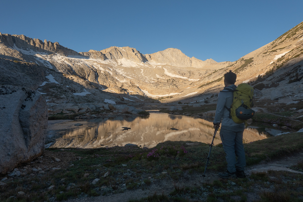
We woke up to a sky full of stars and crisp mountain air. The smoke had dissipated — the wind was in our favor. We did some last-minute packing, brewed some coffee, and ate breakfast. At 5 a.m., we started hiking.
We took the approach at an easy pace, and this beat my approach from last week by several hours. The difference? I actually knew which way to go now. No more time was wasted jumbling through boulder fields and scree.
After hiking past Saddlebag Lake, we followed the lakes basin, only veering high when the use trail went higher. The alpenglow was spectacular, and the morning light made for an interesting setting.
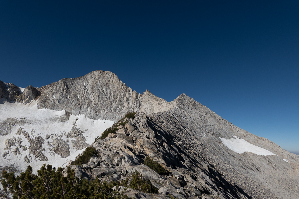
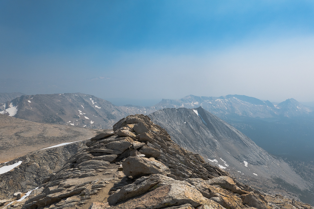
After reaching the last lake — a small ice-filled pond — we hiked up scree to the South Ridge of North Peak. We then held a traverse through the scree and boulders to reach the ridgeline at 11,650 feet. We then descended to the 11,500-foot col of North Peak and Mt. Conness, which began the climb.
That was actually the most dangerous part of the day, from an objective danger standpoint. The traverse from the lakes basin to the ridgeline was exposed to rockfall from the loose surface and the eroding cliffs above. The rest of the day would be fun climbing on solid rock.
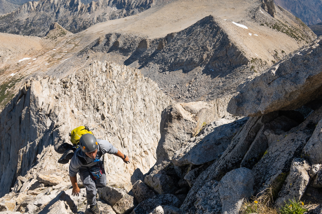
The ridgeline began as class 2 and 3 climbing. When we approached the first tower, it became 4th-class with the occasional 5th-class set of moves. It was high-quality scrambling with extreme exposure to either side.
The easiest way to gain the first tower was to go directly up the ridge crest, which required numerous moves over empty space. It was all phenomenal. Moving unroped over such exposed terrain engaged the mind and body like nothing else. This was Rob’s first time on a “scrambling/climbing alpine trip,” and it was quite an adjustment spending so long, unroped, with massive exposure and consequences. Very different from roped climbing on Yosemite cliffs, but he took it like a champ. There’s nothing like facing fear by fighting it headfirst.
After the first tower, we took the standard traverse on the ledge below a sub-tower just ahead. After the ledge traverse, a party of three caught up with us.
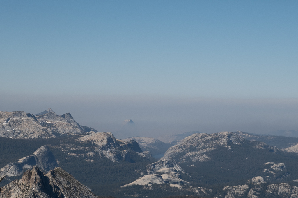
We looked over in the distance. All the high peaks were visible, but wildfire smoke engulfed the national park proper. A temperature inversion was keeping the smoke low and away from us. We even saw Tenaya Peak and the tippy-top of Half-Dome through the smoke.
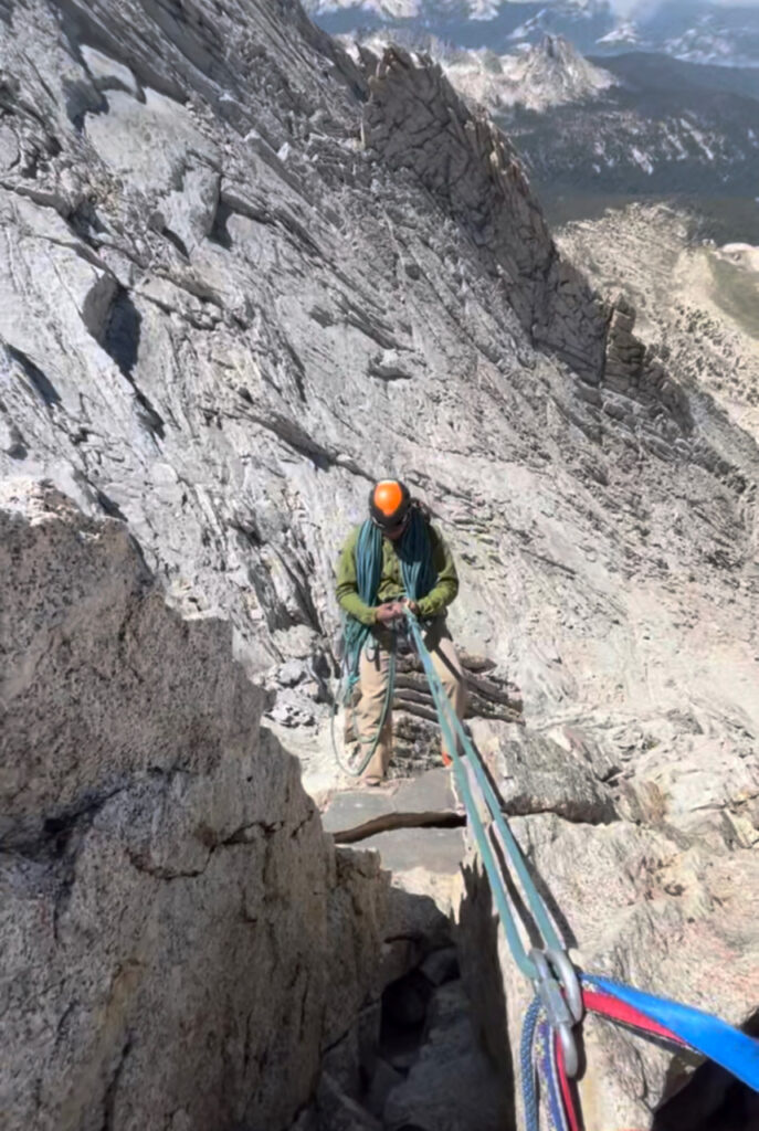
The party of three went ahead to the top of the second tower, which was another few hundred feet of fourth-class scrambling away. The rappel began from here. We waited as they rappelled and down-climbed some sections. When the way was clear, I went to the anchor and set up the rappel.
I set up the first rappel, and rapped to the next rappel anchor. This other rappel anchor is hard to find because it’s a downward traverse away from the first anchor, but I remembered the way from last week.
As I unclipped my rappel device from the rope and called “off rappel,” I dropped my ATC Guide and it clinked down to the glacier. Darn. No more rappel or belay device.
Rob rappelled to me, and I set up the last rappel. I resigned myself to rappelling on a munter hitch. I rapped, with a ridiculous amount of friction. After a third of the way down, the rope was hopelessly twisted around my sling extension. It took various gymnastics to continue downwards. Note to self: don’t rappel on a munter on an extension. And perhaps don’t drop your rappel device. I spent at least 15 minutes on that rappel dealing with the rope twist.
I finally made it down, and Rob rappelled to meet me. Thanks to our early start we had plenty of time for the remaining 5th-class climbing. We decided to pitch it out, swapping leads.
Aside from a few blank sections, protection was ample and could be placed anywhere. There was plenty of natural protection too, in the form of horns and constrictions. Even so, we never had to place more than a few pieces on each pitch — the climbing was cruiser.
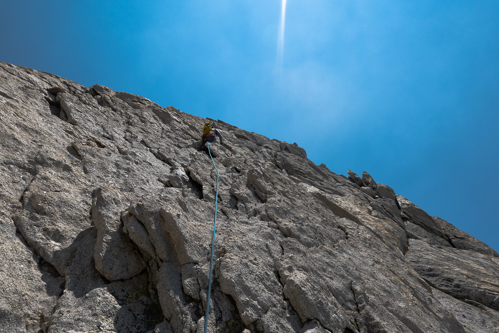
Since we were protecting it rather than soloing, it was a different look at the climb that I had last week. Last week, I had to focus on finding an easier way up. Now, we could climb on fun terrain in complete relaxation. The protection was just an illusion though — an insurance policy against death, not major injury. Most of the climb was an off-vertical traverse, where neither leader nor follower would be allowed to fall.
After a few pitches, I led a pitch right to the ridge crest, with phenomenal exposure. I used an overhanging granite cornice as my anchor, which was the coolest belay anchor I’ve ever used.
While belaying Rob up, what seemed to be a guide and two clients passed us, crossing over our rope. They were moving fast, as the guide was soloing up and then belaying two clients on the same line with a terrain belay. Pretty efficient.
I’ll always let people pass, but they never asked, and crossed over a rope I was belaying on. Pretty rude. Though the terrain was easy, if any of the clients fell, it would’ve yanked my partner off the wall. If they’d asked I would’ve asked them to wait 2 minutes for me to finish belaying the pitch, or just pause belaying in the meantime. It’s basic etiquette. I told the two clients as they passed that they should’ve found a better place to do so, but they didn’t understand what I was saying. Oh well.
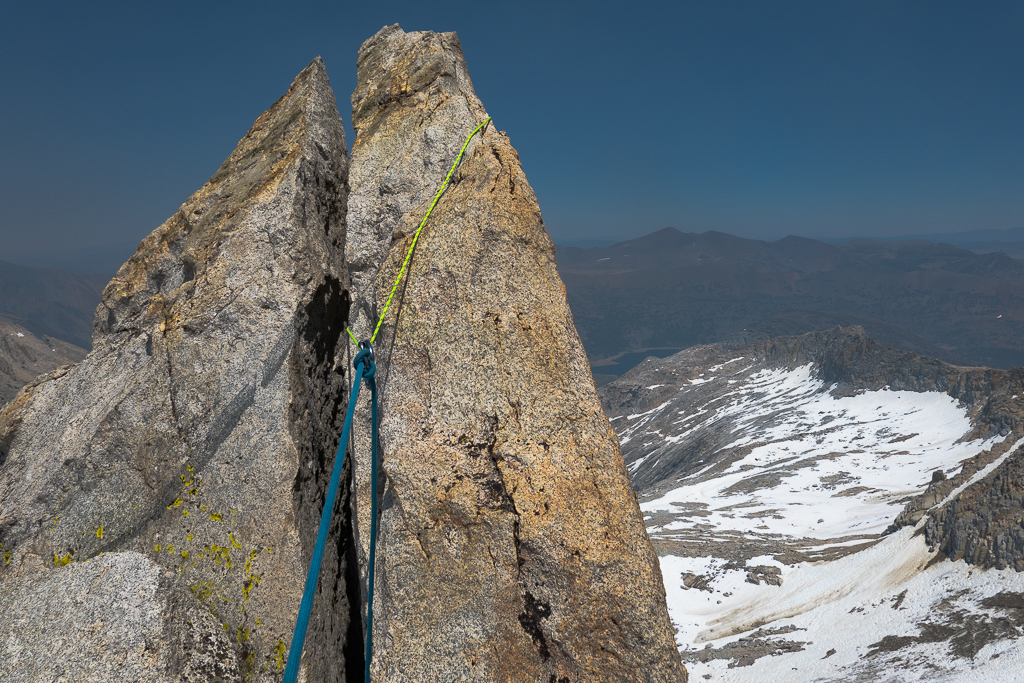
After this pitch, the best climbing began. Rob led the next pitch, an airy traverse before down-climbing a 12-foot chimney. He had to cut that one short due to rope drag. I followed, then took over the next lead.
The summit was a stone’s throw away, but it wasn’t clear where to go. When I did this section last week, I actually rappelled a tension traverse to get past it.
In the end, I made some funky moves on tiny edges and large blocks which brought me from the west side of the ridge to the east side. Then, some more interesting moves brought me from the east side to the west side. I continued traversing. Third-class terrain to the summit was only 20 feet away now, but the rope drag from the double-cross of the rope was ridiculous. I had to build a belay anchor right away.
At the same time, a group of three simul-climbers passed by us, and guess what, they had manners. They asked if they could pass, I said yes, and I didn’t start belaying until they went by. It’s that easy.
They climbed staying on the west side of the ridge, which looked like easier terrain than what I had just done. Good beta for next time.
I belayed Rob over, and he led the final 20 feet, just short of the summit. I went over, and we coiled the rope and packed up the rack. We went to the summit and took some photos.
Now, the wildfire smoke had left the valleys and covered everything in a haze. We could smell it too. It hit at the right time, thankfully. Now, the rest of the day would be downhill with minimal effort. Having to climb through this smoke would’ve been hell.
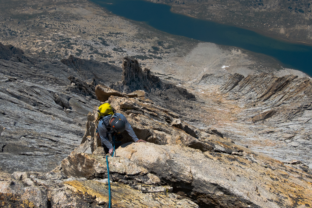
We started to descend, and we opted to use my route from last time — the White Mountain and Mt. Conness col. We were on the tails of the group of three who passed us on the final pitch. They went a different way, towards the East Ridge. I thought that would be a viable descent route last week, but I only saw cliffs. Nevertheless, they went over the ridge, out of sight. Perhaps it’s a hard-to-see ledge system or chute I needed to find.
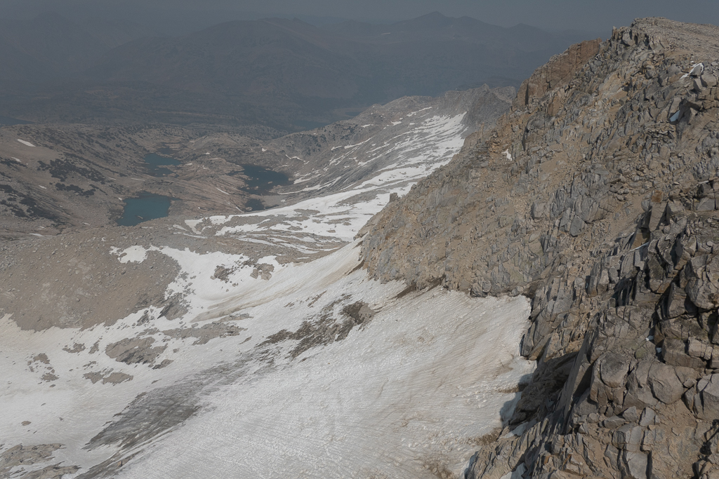
Some easy downhill descending on scree brought us to the Conness and White Mountain col. From there, we descended a very loose boulder field. After that, a few hundred feet of descent on a snowfield brought us to easy ground.
We’d drank most of our water on the climb, but now we were below these melting snowfields. There were streams of fresh water between the rocks, and we drank the crystal-clear water with our mouths against the flow. It was well worth the brain freeze. There’s nothing like fresh, mountain water right at the source.
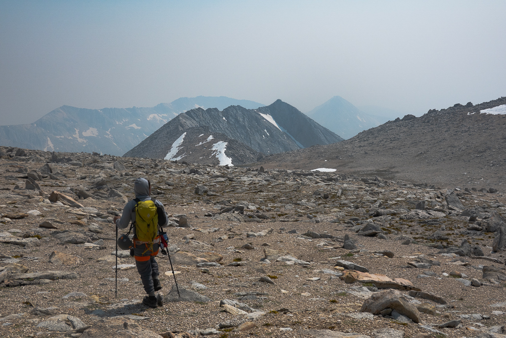
I blundered cross-country most of the way the last time I descended this route. But Rob immediately found a trail of cairns I didn’t see last time. This was a much easier route, and we were maintaining a good 2 – 3 mph descent pace.
When the trail started to parallel the river, the mosquitos came en masse. Last week I didn’t see a single mosquito, but it was cold and windy. We were both wearing long-sleeves and pants, but they would still bite us on our hands, necks, and behind our ears. It was hell.
We continued downhill, and believe it or not, we saw people! We were still pretty high up and so we talked for a bit. They asked if we went to Conness. They said they tried to hike there via our descent route, but couldn’t find a way through the cliffs. It is a little tricky — there’s only this one chute through the cliffs, it seems.
They then said that they saw a group of three descend off the ridgeline and meet them 20 minutes ago. Woah. We left the summit 15 minutes after them and they were only 20 minutes ahead. And, we wasted a lot of time faffing around on the descent. Perhaps this descent route isn’t so bad — the East Ridge must be a mess of boulders and scree.
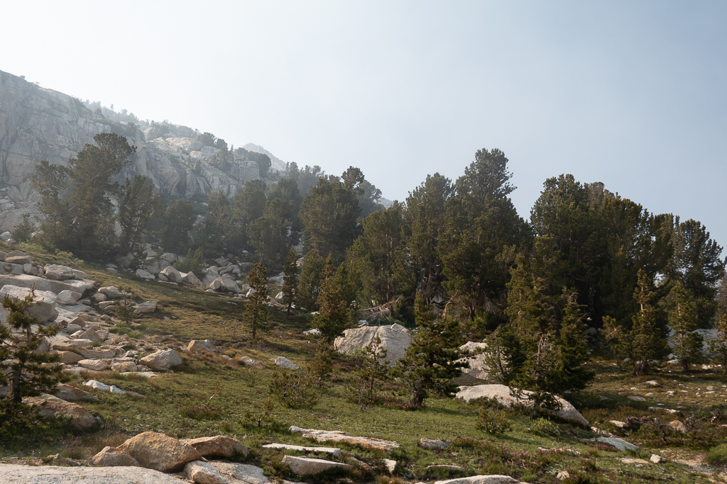
We continued downhill to Sawmill campground. After crossing through the campground, a grueling 20-minute road walk awaited us. We each had a vehicle, and we each had the idea to leave a vehicle at the campground. But, we both forgot the morning of. 20 terrible minutes of walking later brought us to our cars. Road walks are the worst.
We drove back to Lee Vining, but not before jumping into a lake on the way. That would suffice as our shower.
Finally, we devoured some well-deserved food at the Mobil — quickly becoming my new favorite place.